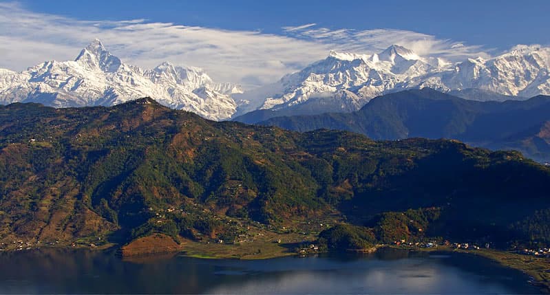
The Annapurna Conservation Area is Nepal's largest protected area, covering 7,629 km² across the Kaski, Manang, Mustang, Myagdi and Lamjung districts of Gandaki Province. Elevation within the conservation area ranges from just 790 m in its lowest subtropical valleys up to 8,091 m at the summit of Annapurna I — a vertical span that, in a single trekking region, moves a hiker through subtropical forest, temperate rhododendron woodland, high alpine desert, and permanent snow and ice.
Overview
Unlike a conventional national park, the conservation area is managed under a community-based model that involves local villages directly in tourism management and conservation decisions, and it remains home to a mix of ethnic communities — including Gurung, Thakali and Manangi populations — whose villages sit along or near the main trekking routes. It encompasses the Annapurna Sanctuary, a high glacial basin ringed almost entirely by peaks over 7,000 m, accessible only through a narrow gorge entrance.
Trekking routes
The region holds several of Nepal's most popular trekking routes. The Annapurna Base Camp trek, typically 7–10 days round trip, climbs into the Annapurna Sanctuary itself, ending at a base camp surrounded on nearly all sides by 7,000–8,000 m peaks. The longer Annapurna Circuit, historically 15–20 days though often shortened today by road access to some sections, loops around the entire Annapurna massif and crosses the Thorong La pass at 5,416 m, the trek's high point. Poon Hill, a shorter 4–5 day trek (or an add-on to either longer route), is one of Nepal's most accessible viewpoints for a sunrise panorama over Dhaulagiri and the Annapurnas, making it popular with trekkers on a tighter schedule or with less high-altitude experience.
Best time to visit
March to May and late September to November are the two main trekking seasons, offering the clearest mountain views and the most stable weather; spring adds blooming rhododendron forests at mid-elevations. Winter trekking on lower routes like Poon Hill is possible but cold at altitude, while the June–September monsoon brings heavy rain, leeches at lower elevations, and significantly reduced visibility of the peaks.
Getting there and permits
Almost all routes in the conservation area begin from Pokhara, reached either by a short domestic flight or a scenic road journey from Kathmandu. An Annapurna Conservation Area Permit (ACAP) and a TIMS (Trekkers' Information Management System) card are required for all routes in the region and are best arranged in Pokhara or Kathmandu before setting out, rather than at the trailhead.
Practical tips
Altitude sickness risk is real on both the Annapurna Base Camp and Circuit routes — build acclimatization days into any itinerary that climbs above roughly 3,000 m, and treat sudden onset headache, nausea or breathlessness at altitude seriously rather than pushing through it. Teahouse accommodation is available along all the main routes, so a tent and full camping setup generally isn't necessary outside of specialized expeditions.